0

Faridpur District


Faridpur is a historic district in central Bangladesh. It is a part of the Dhaka Division. Faridpur District has a population of over 1.7 million people and is situated on the banks of the Padma river (Lower Ganges). It is bordered by Madaripur, Narail, Rajbari, Magura, Shariatpur, Gopalgonj, Dhaka and Manikganj. Once a subdivision, the original area of the district comprised what is today the Greater Faridpur region which includes the present day districts of Rajbari, Gopalgonj, Madaripur, Shariatpur and Faridpur.

Famous for its jute fields, which are considered to produce the finest raw jute, and aristocratic zamindar families, the district was a focal point for political movements in Bengal during the British Raj and the early days of the Pakistan era. It produced some of the most prominent politicians and cultural figures of Bengal.

Contents

[hide]

[edit] Geography

Faridpur is located in central Bangladesh under Dhaka division. The area of this district is 2072.72 km². The district is bounded by the Padma river to the north and east and across the river are Manikganj, Dhaka and Munshiganj districts. It is bordered by Madaripur to the east, Gopalgonj to the south and Rajbari, Narail and Magura to the west.

The soil is highly fertile as the district lies on the banks of the mighty Padma river, also called the Lower Ganges. Other smaller rivers include Old Kumar, Arial khan, Gorai, Chandana, Bhubanshwar and Modhumoti. The main depressions are Dhol Samudra, Beel Ramkeli, Shakuner Beel and Ghoradar Beel.


[edit] History

In 1582 in the ring of Emperor Akbar, the province of Bengal was formed into 33 sarkars or financial sub-divisions, and Faridpur area appears to have been included with in the sarkar of Muhammad Abud. During the Emperor Shah Jahan, these divisions were carried onto such an extent as to cause in a falling of the imperial revenue. In 1721 a new partition of the country was made the province of Bengal being formed into 13 large divisions (chaklas) instead of sarkars. In 1765 the financial administration of Faridpur, together with the rest of Bangal was captured by the English, and in 1790 the criminal administration of the country at the correctors were invested with magisterial powers. In 1793 the collectors were relieved of their magisterial duties and separate officers were appointed united Judicial and Magisterial power together. The greater portion of Faridpur was then comprised within Dacca Jalalpur. In 1811 Faridpur was separated from Dacca collectorate.

The district was initially known as Fatehabad. In 1860 the district was named as Faridpur after 12th Century Sufi saint Shah Sheikh Fariduddin. Faridpur town was declared a municipality in 1862 and a District Prison was set up in 1865. In 1840 the Faridpur Zila School was established and is one of the oldest schools in modern day Bangladesh.

The original district stretched out across central Bengal, comprised of the what is, today, the Greater Faridpur region. A politically important district during the British Raj, Faridpur became a sub-division of Dhaka Division after the creation of Pakistan. In 1984, with the Decentralization Program of the Bangladesh government, Faridpur district was broken into five separate districts: Rajbari, Gopalgonj, Madaripur, Shariatpur and Faridpur.

Faridpur is notable for its rich zamindari history. Most of the zamindar families were Hindus. They included the Basu Roys of Gopalgonj, the Sikdars of Kanaipur, The Bhawal Rajas of Pangsha, the Lords of Choddo and the Baish and Roshi estates of Bhanga. During the reign of the Nawabs of Bengal, several Muslim zamindaris were established. They included the Chanpur Estate and the Boalmari Estate in present day Faridpur, Golam Ali Chowdhury of Idilpur pargana and the Padamdi Nawab Estate in present day Rajbari. The most powerful Muslim landlords were Nawab Abdul Latif and Chowdhury Moyezuddin Biwshash.

During the 1800s, Haji Shariatullah, after returning from Mecca, began the famous Faraizi movement aimed at ending the persecution of Muslims by upper caste Hindu zamindars. The Indigo Resistance Movement which resisted Indigo plantations promoted by the British East India Company, also began in Faridpur. The movement was led by Pir Dudu Miah.

The Greater Faridpur region is also famous for producing some of the finest politicians of the Indian Subcontinent. They include Baba Ambika Charan Majumder, Maulvi Tamizuddin Khan, Bangabandhu Sheikh Mujibur Rahman, Mohonmiah Yusuf Ali Chowdhury , Buddhadeb Bhattacharya , Humayun Kabir and many more.

Faridpur hosted several key meetings of the Indian Independence movement. It was regularly visited by Subhash Chandra Bose, Chittaranjan Das, Rabindranath Tagore, and Maulana Abul Kalam Azad. The annual conference of the Bengal Congress held on the grounds of the Moyez Manzil Palace in Faridpur in 1921 was attended by Mahatma Gandhi.

After the creation of Pakistan, Bengali nationalists frequently held large rallies in Faridpur. Huseyn Shaheed Suhrawardy and Sher-e-Bangla A. K. Fazlul Huq would regularly visit the district. Prior to the elections of 1954 which brought Bengali nationalists to power in Faridpur, the Jukta Front coalition held a massive rally on the grounds of the Biwshash Bari zamindar mansion in the village of Chanpur, just outside Faridpur. The rally was attended by Huseyn Shaheed Suhrawardy, Maulana Abdul Hamid Khan Bhashani and Sher-e-Bangla A. K. Fazlul Huq.

Faridpur also saw many ruthless atrocities during the Bangladesh Liberation War. On April 26, the Pakistan army landed on Daulatdia river port (now in present day Rajbari) and began a massacre as soldiers went from village to village killing sleeping civilians during dawn.

[edit] Demographics

Faridpur has a population of 1,714,496 people according to the 2001 census. 50.55% of the people are male and 49.23% are female. The major religions are Islam and Hinduism. 88% of people are Muslims in the district. Although once a Hindu dominated district, Hinduism has significantly declined in Faridpur with only 11% of the population being Hindu. The major ethnic group are the Bengali people, as is the case in most of Bangladesh. There is also a small Bihari and Oriya population.


[edit] Administration

Faridpur district consists of 9 upazilas, 4 municipalities, 79 union parishads, 36 wards, 92 mahallas and 1859 villages. The town consists of 9 wards and 35 mahallas. The area of the town is 20.23 km². The population of the town is 99634; male 51.73%, female 48.27%. The density of population is 4925 per km². The literacy rate among the town people is 66.6%. The town has two dakbungalows.

Faridpur district is divided into the following upazilas:

  1. Faridpur Sadar Upazila
  2. Boalmari Upazila
  3. Alfadanga Upazila
  4. Madhukhali Upazila
  5. Bhanga Upazila
  6. Nagarkanda Upazila
  7. Charbhadrasan Upazila
  8. Sadarpur Upazila
  9. Shaltha Upazila

[edit] Education

[edit] Economy

Despite its colonial importance, Faridpur and its surrounding districts remain as one of the most under developed regions of modern day Bangladesh. Communications except for the municipalities, are very poor. Moreover, the district's transport with Dhaka is severally effected as there is no bridge over the Padma river to connect with Dhaka and thus, people of the district rely on slow and often deadly ferry services.

The district has an aggro-based economy. The main crops are jute and paddy. Other crops include peanut, wheat, oilseed, pulse, turmeric, onion, garlic and coriander. Many fruits are also produced, notably mango, jack fruit, black berry, palm, coconut, betel nut, kul, tetul, bel, papaya, banana, and guava. The main exports are jute, Helsa fish and sugarcane.

Faridpur is famous for producing high quality raw jute. Once the principal earner of the country's economy, the jute industry has suffered a decline in recent years due to low prices on the international market, leading to many jute plants shutting down. However, Faridpur still has quite a few which are also some of the most prominent. They include notably Faridpur Jute Fibers and Sharif Jute Mills.

The district, being on the banks of the Padma, also accounts for a significant portion of exports of Helsa fish. The Helsa found in Padma are immensely popular at home and abroad and are called the Silver Helsa. The district has thriving fisheries and a growing poultry industry.

Manufacturing is moderate in the district although there are several industries. Kanaipur Industrial Area was set up in Faridpur town during late 1980s. There are many sugar mills and jute plants as well. Some of the leading industries of the district are listen below:

  • Faridpur Jute Fibers
  • Aziz Jute Fibers
  • Aziz Pipes
  • Faridpur Sugar Mills
  • Khankhanapur Textile Mill
  • Saiyed Jute Spinning
  • Karim Jute Mill
  • Faridpur Cold Storage
  • Sharif Jute Mill
  • BADC Cold Storage
  • Rokeya Textile
  • A H Jute Mills

In 2009, the Bangladesh government announced plans to construct the long demanded Padma Multipurpose Bridge. When completed in 2012, it will be the longest bridge in South Asia. The Padma bridge will greatly help in developing the Greater Faridpur region as it would connect Dhaka with the districts.

[edit] Places of interest

  • Kobi Jasimuddin's House: Residence of the renonwed Bengali poet Jasimuddin
  • Faridpur District Court: 19th century colonial styled court house
  • Mazar of Dewan Saker Shah: Mausoleum of the Dewan of the Boalmari Estate
  • River Research Institute: a government research institute
  • Moyez Manzil Palace: a mansion of the Chanpur Estate
  • Baisrashi Bari Palace: a mansion of the Baisrashi Estate
  • Kamlapur, Faridpur: historic neighbourhood housing colonial buildings and zamindar mansions
  • Dighir Par Masjid: a mosque in Bhanga built during the Mughal era
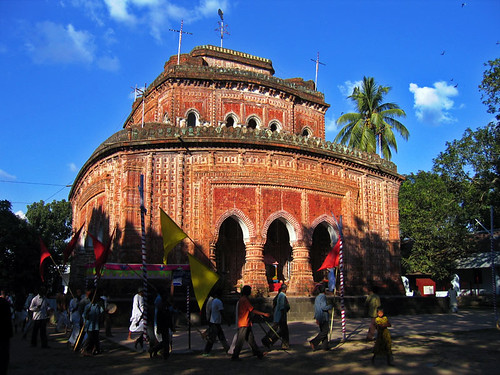
  • Basudeva Mandir: famous Hindu temple
  • Faridpur Zila School: one of the oldest schools in Bangladesh

[edit] Personalities

Read more
1

Dinajpur District


Dinajpur (Bengali: দিনাজপুর) is a district in Northern Bangladesh. It is a part of the Rajshahi Division/ proposed Rangpur division.

Contents

[hide]

[edit] Geography

Dinajpur [1] is bounded by Thakurgaon and Panchagarh districts in the north, Gaibandha and Joypurhat districts in the south, Nilphamari and Rangpur districts in the east, and the state of West Bengal, India in the west. The total area of the district is 3,437.98km2.[1] Annual average highest temperature 33.5 °C and lowest 10.5 °C; annual rainfall 2,536mm. Main rivers are Dhepa, Punarbhaba, Kanchan and Atrai.

[edit] Subdivisions

Sub-districts or Upazilas are Birampur Upazila, Birganj, Biral Upazila, [[Bochaganj/setapganj] Upazila]], Chirirbandar Upazila, Phulbari Upazila, Ghoraghat Upazila, Hakimpur Upazila, Kaharole Upazila, Khansama Upazila, Dinajpur Sadar Upazila, Nawabganj, Parbatipur Upazila.

[edit] Population statistics

  • Total Population is 2,617,942(According to the census of 2001 and Bangladesh Statistical Beauro )[2].[citation needed] Among them male 51.12%, female 48.88%.
  • Muslim 76.65%, Hindu 20.58%, Christian 0.80%, Buddhist 0.11% and other 1.86%.
  • Ethnic nationals: the Santal and Oraon.
  • Average literacy 60%; male 34.7% female 19.5%.
  • Main occupations Agriculture 42.85%, agricultural labourer 29.19%, wage labourer 2.48%, commerce 10.2%, transport 1.67%, service 5.58%, others 8.03%.
  • Land control Landless 40%, small farmers 30%, medium farmers 25%, large farmers 5%; per capita cultivable land 500m2.

[edit] History

Dinajpur was once a part of the ancient state of Pundravardhana. Devkot which rotated as capital of Lakhnauti was located 11 miles south of Dinajpur town. The British administrative control in Dinajpur was established in 1786 (ref. Banglapedia). At the time of Partition of Bengal in 1947, part of greater Dinajpur district was included in West Bengal and it was named West Dinajpur district. People of the district took part in the Tebhaga Movement and also had significant contribution in the War of Liberation of 1971. [3]

An ancient engraved stone, believed to be from the Gupta era, was recovered from the bank of a pond near Sura Masjid at Ghoraghat Upazila in Dinajpur in October 08.

[edit] Archaeology

Kantaji's Temple [4] [5], Sitkot Bihar (the oldest Badya Bihar in the world), Rajbari, Dinajpur Museum, Ramsagar DiGhee, Sukhsagar, Matasagar and the tombs of Chehel Gazi and Gora Shahid Moydan, Sitar Kuthuri, Habra Zamindar Bari, Gour Gabindha, Baraduari, Shingha Darwaza Palace, Nayabad mosque, Aowkora(echoing) Mosque.

[edit] Economy

The economy of Dinajpur mainly depends upon agriculture based production. Dinajpur is famous for rice production. 'Katharivog' rice is the best produced rice in Bangladesh. Dinajpur is also rich with wheat production.The liches(fruit) of Dinajpur is the best of Bangladesh.Dinajpur is also famous for its Mangoes. "Kosba" is called the matrix of mango. Also it grows a plenty of vegetables and seasonal fruits. A huge percentage of people from Dinajpur depends upon agri based products. The main industry also includes rice processing mills. However, Dinajpur is highly rich with natural resources like coal. The coal of Boropukuria Coal Mine is empowering a 250MW power generation plant. More sites are discovered to have coal. Asia Energy PLC is a new company,without any history of previous mining experience, quoted in the London Alternative Investment Market, set up to exploit open cast coal mining opportunities in the Phulbari region of Dinajpur..

[edit] Education

Hajee Mohammad Danesh Science and Technology University [6] is a government financed public university of Bangladesh is situated at 5 km away from Dinajpur main town. It serves as the premier institution of science and technology in northern part of the country. There are two government colleges in the dinajpur town. One is for famale student and another is for male student. [7]. The former name of the female govt college is Surendranath college. Both colleges are under national university. Here is a govt. medical college which is one of the 17 govt funded medical college in Bangladesh.It is a medical college located in Dinajpur town. It is a Government medical college and admits 150 students into the 5 year MBBS (Bachelor of Medicine and Bachelor of Surgery) degree program.12 batches have passed from this medical college. Dinajour Medical College Journal published by Dinajpur Medical College twich in year is BMDC recognized Journal (ISSN: 2070-2019). Now a modern technology based hospital will be opened soon. Dinajpur also has got the second BKSP(Bangladesh Krira Shikkha Protisthan) in Bangladesh. It also has a poly-technical institution. 10th educational board of Bangladesh has been established in Dinajpur in 2007. From 2009 S.S.C (Secondary School Certificate) and H.S.C.(Higher Secondary School Certificate) exams have been started to be taken. In S.S.C. exam for the first time it stood 2nd in the country in the G.P.A. 5 list.

[edit] Places of interest

Shopnopuri amusement park
  • Kantanagar Temple [8] [9]
  • Nayabad Mosque
  • Kaliya Jue Temple
  • Dinajpur Rajbari
  • Ramsagar
  • Hili Land Port
  • K. T Complex
  • Shopnopuri artificial amusement park
  • Nowpara Ideal Village
  • Rudrapur Dipshikha School [10]

[edit] Fruits

Mango, banana, jackfruit, litchi, blackberry, coconut.

[edit] See also

Read more
0

Comilla District


Comilla (Bengali: কুমিল্লা) is a city in south-eastern Bangladesh, located along the Dhaka-Chittagong Highway. It is the administrative center of the Comilla District, part of the Chittagong Division.

Contents

[hide]

[edit] History

The Comilla region was once under ancient Samatat and was joined with Tripura State. This district came under the reign of the kings of the Harikela in the ninth century AD. Lalmai Mainamati was ruled by Deva dynasty (eighth century AD), and Chandra dynasty (during tenth and mid eleventh century AD). It came under the rule of East India Company in 1765. This district was established as Tripura district in 1790. It was renamed Comilla in 1960. Chandpur and Brahmanbaria subdivisions of this district were transformed into districts in 1984.

[edit] Historical events

Peasants Movement against the king of Tripura in 1764 under the leadership of Samsher Gazi is a notable historical event. Born in an ordinary peasant family Shamsher Gazi became the ruler of the entire Chakla Raushanabad which was spread over the south of Comilla and the north of the Noakhali districts. Gradually he brought the whole of the Comilla district under his control. Later he conquered Nizampur Pargana, thus making himself the uncrowned king of the region between the Meghna, the Muhuri and the Manuganga rivers.[1]

Shamsher Gazi was born of a poor Muslim peasant family in the year 1712 at Kungura village under Dakshin Shik pargana north of Chittagong which formed part of Tripura's Manikya kingdom. While working as 'Tehshildar' in the local landlord Nasir Mohammed's office Shamsher is said to have received divine blessing of a 'Pir'.[2]

Presently a part of Comilla's Court Road, the photographed street has been once an extension of historic Grand Trunk Road, to communicate with the port facilities of Chittagong.

From his very boyhood, Shamser Gazi was intelligent and brave. Chakla Raushanabad was at that time under the jurisdiction of the state of Tripura. Its zamindar was Nasir Mahmud. Nasir Mahmud brought Shamser up with love and care. Young Shamser was ambitious. Shamsher Gazi came to grief after his proposal to marry the landlord's daughter was rudely rejected and he was ordered to be nabbed. Shamsher Gazi organized an armed force. He soon captured Nasir Mohammed's domain in 1745.

Towards the beginning of the British Raj, zamindari oppression had made the life of the peasants and farmers miserable. Shamsher Gazi was wise, efficient, kind and a bountiful ruler. He granted rent exemption to poor peasants, managed the economy well and this led to the reduction of the prices of essential commodities. He granted freeholds to many Hindus and Muslims. He dug numerous ponds and built many schools in and outside his capital Jagannath Sonapur. Of the ponds he dug, 'Kaiyar Sagar' was the largest.[3]

Having consolidated his position as landlord of Dakshin Shik and Meherkul parganas Shamsher turned his attention to Tripura and ousted King Krishna Manikya after a brief conflict in the year of 1748. He encountered serious opposition from the tribal subjects in the hilly interiors of the state who fought behind the king of Tripura.[4]

The king of Tripura Krishna Manikya sent two expeditions of the powerful Kuki armies against Shamser Gazi. Both failed before Shamser's extraordinary military acumen and heroism. Shamser Gazi conquered Udaypur, the capital of Tripura. The king fled to Agartala and sought the protection of Nawab MIR QASIM. Shamsher Gazi was killed in 1760 when he responded to a false invitation for a dialogue with the nawab. Thus Krishna Mainkya was able to regain his lost Kingdom.

Communal tension spread over Comilla when a Muslim was shot in Comilla town during the partition of bengal in 1905. During the preparation of a countrywide hartal on 21 November 1921, Kazi Nazrul Islam composed patriotic songs and tried to awaken the town people by protesting the Prince of Wales's visit to India. During this time, Avay Ashram, as a revolutionary institution, played a significant role. Poet Rabindranath Tagore and Mahatma Gandhi visited Comilla at that time. In 1931, approximately four-thousand peasants in Mohini village in Chauddagram upazilla revolted against a land revenue tax. The British Gurkha soldiers fired indiscriminately on the crowd, killing four people. In a huge peasant gathering, the police fired at Hasnabad of Laksham Upazila in 1932. Two people were killed and many were wounded.

In 1931, on 14 December Sunity Choudhuri and Shanti Ghosh from Faizunnesa Girls School shot dead Magistrate Mr. Stevens. This was the first time that women come to the forefront in armed struggle for freedom.

Marks of the War of Liberation mass killing site: 5, Laksham, Comilla Cantonment, Homna, Beltali and Rasulpur; mass graves at Betiara, Muzaffarganj, Nagaripara, Cantonment, Krishnapur, Dhananjay, Dilabad and Laksham Bidi Factory; memorials at Comilla Victoria College, Betiara, Police Line, Cantonment, Laksham, Polytechnic Institution and Haratali.

[edit] Geography and climate

Comilla is located at 23°27′0″N, 91°12′0″E, and has a total area of 280 square kilometers. It is bounded by Burchiganj and Tripura on the north, Laksham and Chauddagram on the south, and Barura on the west. The major rivers that pass through Comilla include Gumti and Little Feni.

The Tropic of Cancer (23°5') crosses Comilla town on the south side just over the Thomson Bridge.

[edit] Climate

Height about 6m / 19 feet above sea level. 24-hr Average Temperature Respectively :

Jan Feb Mar Apr May Jun Jul Aug Sep Oct Nov Dec °C 19.0 21.4 25.6 27.8 28.5 28.2 28.0 28.1 28.3 27.3 23.9 20.1

[edit] Administration & Development

Comilla, as a district, is generally administrated by a Deputy Commissioner (DC), who is a government official of the district. However, civil society is quite strong in voice and activity here. The DC office is situated at Fauzdari area of the town on the east side of Dharmasagar. The District of Comilla has been divided into sixteen Tanas, namely Comilla Adarsa Sadar, Comilla Sadar South, Hoamna, Laksham, Muradnagar, Devidwar, Daudkandi, Burichang, Barura, Chandina, Titas, Meghna, Chowddogram, Langolkot, Brahmanpara and Manohargonj.

The main town of Comilla is under the Sadar Tana. Comilla Cantonment is one of most important military bases and is the oldest in East Bengal. It was widely used by the British Indian Army during World War II. There is a war cemetery in Comilla that was established after the World War II to remember the Allied soldiers who died during World War I and II, mostly from Commonwealth states and the United States. There are a number of Japanese soldiers were buried there as well.

Comilla also has an Export Processing Zone (EPZ) at the east end of the town, established on the former site of an airport. Presently only the runway still exists, whereas other establishments have been converted to instruments of the EPZ. It is one of the first growing EPZ(s) in Bangladesh.Recently 2008 some occurrence by BEPZA GM , 4 Running Factory layoff.

Pourashabha Road. A main road of Comilla that enters the town from district's major bus terminal.

Comilla is well known as a city for education; educational institutions include Comilla University, Comilla Medical College, Comilla Victoria College, Comilla Cadet College (formerly Comilla Residential Model College). BARD at Kotbari is well known for research on rural development, which is a brain child of the eminent educationist Dr. Akhter Hamid Khan (formerly Principal of Comilla Victoria College, formerly Sub-Divisional Officer). His formula for Rural Development has four subdivisions, namely Cooperatives, Irrigation, Rural Works, and Plan Books. Based on this theme, a reputed government organisation, LGED, was formed, which is headed by an Executive Engineer in districts and holds three of the themes of Dr. Akhter Hamid Khan.

Natural gas is the main natural resource of this district. Bakhrabad Gas Company has its headquarters in Comilla.

[edit] Land and economy

Main occupations Agriculture 43.28%, commerce 11.6%, service 10.78%, transport 3.36%, agricultural labourer 15.89%, wage labourer 2.46%, construction 1.03%, and others 11.6%.

Land use Total cultivable land 243596.93 hectares; single crop 18.05%, double crop 63.99% and treble crop land 17.96%.

Land control Among the peasants 30% are landless, 46% small, 20% intermediate and 4% rich.

Value of land The market value of the land of the first grade is 135000 Taka per 0.01 hectare.

Main crops Paddy, jute, wheat, mustard seed, brinjal.

Extinct or nearly extinct crops Linseed, sesame, sweet potato, china and kaun.

Main fruits Mango, jackfruit, banana, coconut, palm, guava and blackberry.

Fisheries, dairies, poultries Dairy 28, poultry 109, fishery 27, hatchery 69, nursery 200.

Manufactories In the second half of the eighteenth century east India company established a large cotton mill at Charpata on the south of the district. Cotton cloths were exported to other districts in those days. At present Comilla Khaddar is famous in the country. Manufactories include textile mills: Halima Textile Mills; iron and steel factory: Mozaher Cooperative Mills, Radharani Manufacturing Works, Qayum Steel Mills Ltd.; pharmaceuticals- Skylab, Comilla Ayurvedic Pharmacy, Sharma Chemical (extinct), Arco Industry.

Manufacturers of popular Comilla sweetmeats are mostly based on this Manoharpur area of the town.

Cottage industries Comilla is noted for potteries of Bijoypur. Other cottage industries include bamboo and cane works, Shital Pati, hooka, and madur (mat) made of murta tree.

Main hats, bazars and fairs Most noted hats, bazars and fairs (Mela) are Dulalpur, Companyganj, Rajganj, Bibir Bazar, Daulatganj,Nangalkot, Nimshar, Chandina, Gunabati Bazar, Homna, Ramchandrapur, Bangshanagar, Chauddagram, Govindapur, Monipur, Chandimura, Madhavpur, Mohanpur, Rasulpur, Syedpur, Madhaya, Eliotganj, Baroikandi, Changini Bazar, Chawkbazar, Mainamati Mela, Punra Mela, Chandala Mela, Baira Mela, Betakhali Mela, Thanda Kalibari Mela, LAKSAM BAZAR,KHELA BAZAR, Tomsombridge,Easin market,EPZ Gate Ishaq Market,

Main exports khaddar cloth, coconut, dry chilly, dry fish, egg, poultries, Knitting Sweater, Denims,Under Garments, and potteries.

Mineral resources natural gas (Bakharabad in Sreekail. Bakhrabad gas field lies in the Muradnagar upazila under Comilla district some 40 km away to the east from capital city of Bangladesh, Dhaka. Like Titas & Habiganj fields Bakhrabad gas field was discovered by Pakistan Shell Oil Co. Ltd. in 1969. The Bakhrabad anticline, as defined by seismic, is a narrow, elongate almost symmetrical fold about 69 km long up to 10 km wide. Total recoverable gas reserves of this field re-estimated by Hydrocarbon Unit is 1,049 billion cubic feet (29.7 km3). Commercial gas production from this field was started in 1984 and till August 31, 2006 total 658.110 billion cubic feet (18.6356 km3) or 62.74 percent of reserves has been recovered.

[edit] Sub-divisions

Comilla district consists of the following upazilas:[5]

  1. Barura Upazila
  2. Brahmanpara Upazila
  3. Burichong Upazila
  4. Chandina Upazila
  5. Chauddagram Upazila
  6. Daudkandi Upazila
  7. Debidwar Upazila
  8. Homna Upazila
  9. Comilla Adarsa Sadar Upazila
  10. Laksam Upazila
  11. Monohorgonj Upazila
  12. Meghna Upazila
  13. Muradnagar Upazila
  14. Nangalkot Upazila
  15. Comilla Sadar South Upazila
  16. Titas Upazila

[edit] Demographics and culture

Comilla is famous for different types of sweets and Batik printed cloth. The people of Comilla are multiethnic. To some extent, there is more Afghan and British heritage in Comilla. Green or hazel eyes are more common in Comilla than in other parts of Bangladesh.

It is a highly Muslim dominated area and one can find many economically backward people. But it is home district of many educated Bangladeshis who have achieved great success in their career as Bangladeshi expatriates or in other parts of the Nation. The majority of the denizens lead an agrarian lifestyle, depending on their fields for their livelihood. A much smaller number of Hindus are present in this area. Every Muslim festival is celebrated in big way. Especially Eid and Ramzan. Most of the Muslims are Sunni and few are Shia. There is electricity in most of the area at present in Comilla.

In the suburb there exists the Commonwealth War Cemetery Memorials, Muktajuddha Museum at Mainamati Cantonment and Bangladesh academy for rural development, Mainamati Museum, Comilla Cadet College at Courtbari. Comilla Town is blessed with the memories of national poet Kazi Nazrul Islam. Nazrul Islam married twice in life, one at Daulatpur of Muradnagar upazila of the district and the other at Comilla Town. Those places have been marked with memorial plates. Poet Rabindranath Tagore visited Comilla twice. Ustad Muhammad Hussain, Fazle Nizami and Kulendu Das have enriched the cultural heritage of the town. Ustad Ayet Ali Khan established a musical institute here.

Marks of rich ancient civilization have been found in Lalmai Mainamati hills. In these hills there are plenty of archaeological sites including Shalvan Vihara, Kutila Mura, Charandra Mura, Rupban Mura, Itakhola Mura, Satera Ratna Mura, Ranir Banglar Pahar, Ananda Bazar Palaces, palaces of Bhoj King, Chandi Mura, etc. Various archaeological relics including images and metalled utensils discovered from these viharas, muras and palaces are now preserved in the Mainamati Museum. Other archaeological heritage and relics include Saptaratna Mandir (Jagannath Mandir), Shah Suja Mosque, Dharmasagar, Chandimata Mandir (on the top of Lalmai Hill of Barura), Chandala Shiva Mandir (Brahmanpara, eighteenth century), Saitshala Jami Mosque (Brahmanpara, 1719), Mazars of Panch Pir (five saints) at Shashidal (Brahmanpara, 1815), Harimangal Math (Brahmanpara, 1822), Ramnagar elongated Math (Brahmanpara, 1705), Saitshala Rammahan Mandir (Brahmanpara, 1805), Hasnabad Math.

[edit] Transport

Comilla has good communication network. It is known as the hub of road communication of eastern part of Bangladesh . One of the oldest highways of the Indian Sub-continent, 'The Grand Trunk Road' has approached through the city. At present, the most important Dhaka-Chittagong highway bypass the city from the cantonment to Poduar Bazar. Comilla is located at 97 kilometers from the capital city, Dhaka. This can be travelled by road or railway. The trains has to travel 197 kilometers and takes over 3 hours to Comilla, however buses take about 2 hours only. Hundreds of trucks & lorries travel to or from Comilla with goods. Prominent bus services to Comilla are Tisha, Asia Line, Prince etc.As Public Goods Carrier Messey ferguson Tractor Used last 30 years.Mr Hazi Mohiuddin one of pionear Transport Businessman who first started Machenery Cultivation Tractor & Rotavetor in 1981.

Comilla's highway at Elliotganj. Comilla is the transit point between Dhaka-Chittagong trade route.

Road networks are administered by RHD, LGED and Municipalitis. RHD and LGED have regional headquarters in Comilla. RHD is responsible for National Highways, Regional Highways and District Roads; LGED is responsible for Upazila Roads and Union Roads; where as Municipalities are responsible for municipal roads.

Communication facilities Roads: pucca 1219 km, mud road 587 km; railways 108 km; airport 1.

Traditional transport Palanquin, horse carriage, bullock cart, dhuri and bhari. These means of transport are either extinct or nearly extinct.

[edit] Education

The Comilla Board of Secondary and Higher Secondary Education is located in Comilla. This is the central administration that conducts primary, secondary, and higher secondary education for several districts. Historically, Comilla Board administered the education system of the whole Chittagong Division, but recently, Chittagong and Sylhet Education boards were spun off.

Comilla is also the location for-

etc.

[edit] Closest Towns

[edit] Notable Personalities

[6]

Freedom Fighters


Politicians

etc.
Social Activists and Philanthropists

  • Nawab Faizunnesa, poetess, pioneer in woman's education, founder of Faizunnesa Girls’ School
  • Maheshchandra Bhattacharya (1858-1944), munificent
  • Capt. Naren Dutta, physician and founder of Srikail College
  • Dr. Zobaida Hannan, physician (gynecologist), philanthropist and Ekushey Padak laureate.
  • Munshi Faruque Ahmed (b.1955), former Joint Secretary of Jatiyo Samajtantrik Dal, founder of numerous educational institutions and social development organizations in the region

etc.
Educationists and Scholars


Literature

  • Buddhadeb Bosu (1908-1974), legendary Bangla poet, novelist, translator, editor and essayist
  • Anis Chowdhury (1929-1990), novelist and dramatist
  • Mohammad Kasem (1905-1957), editor and publisher
  • Abdul Kadir (1906-1984), researcher, poet and editor
  • A.K.M. Ali Akbar Khan (1931-1999), poet, renowned teacher and scout master


Music

  • Sachin Dev Burman (1906-1975), recognized as S.D. Burman, singer, composer and music director
  • Jan-e-Alam Chowdhury (1884-1967), tabla player
  • Ustaad Mohamed Husain Khasru (1903-1959), classical musician and composer
  • Himangsu Kumar Dutta (1908-1944), musician and composer
  • Shukhendu Chakrabarty (1928-1989), lyricist, musician and composer
  • Shoila Devi (1916-1944), singer
  • Rahul Dev Burman, recognized as R.D. Burman, son of S.D. Burman, composer and pioneer in Bollywood music direction
  • Fazle Nizami (1933-1984), music teacher & Rabindra sangeet singer
  • Badal Roy, USA based tabla player
  • Asif akbar ( most popular singer of Bangladesh new genaration )

etc.

Journalists

  • Md. Aktar Hossain(journalist), A reporter of Daily Jaijaidin & Daily Ruposhi Bangla. Mr. Aktar Hossain is a Editor of COMILLAWEB, the first online newspaper of comilla district http://www.comillaweb.com.

Others

[edit] References

  • The list of notable personalities is collected from the following:
  • 1. Bangla Academy Caritabhidhan ( Dictionary of Biography), 2nd ed, by Selina Hussain & Nurul Islam, Dhaka , 1997.
  • 2. Mahasthavir Shilabhadra by Shahidullah Mridha, 1st ed, Bangla Academy, Dhaka, 1994.
  • 3. Research by The Modifier.
Read more
0

Kuakata


Kuakata (Bangla: কুয়াকাটা) is a scenic sea beach in south-western Bangladesh. It is about 320 Kilometres south of Dhaka, the capital, and about 70 Kilometres from the Patuakhali District headquarters. The kuakata beach is 30 km long and 6 km wide. On 13 September, 2007 government had announced a red alert in Kuakata as caution for a possible Tsunami.[1]

Kuakata is a famous tourist destination for people from both home and abroad. The significantly exclusive feature of the beach is that due to its "Cross Bow" like shape one can see both sunrise and sunset from some of its locations.[2] The government and local business owners have made significant developments over the years to attract tourist to its shores. Not so long ago tourists were uncomfortable to visit Kuakata due to poor communication systems and dangerous road conditions. Beside that the local communities were not very supportive towards the tourists; resulting some unpleasant events in the beach area.

These days, however, people are more business concerned and communications are much better than before. A new Police station was build 4 years ago and community awareness is in place. The law and order situation in the open beach, even at night, has improved significantly.

Read more
0

St. Martin's Island


St. Martin's Island is a small island in the northeast part of the Bay of Bengal, about 9 km south of the tip of the Cox's Bazar-Teknaf peninsula, and forming the southernmost part of Bangladesh. It is the only coral island in Bangladesh. It is about 8 km west of the northwest coast of Myanmar at the mouth of the Naf River. The local name of the island is "Narical Gingira", also spelled "Narikel Janjina/Jinjera", translated from Bangla, meaning 'Coconut Island'.

St. Martin's Island has become a popular tourist spot. Currently, three shipping liners run daily trips to the island, including Sea-Truck and Keary-Sindbad. Tourists can book their trip either from Chittagong or from Cox's Bazar. The surrounding coral reef of the island has an extension named Chera Dwip.

In the past 5 years St. Martin's visitor population has increased dramatically. While this situation has proven to be lucrative for the islanders, it is causing the natural beauty of the island to deteriorate. Presently there are many efforts being put forth to preserve the several endagered species of turtles that nest on the island, as well as the corals, some of which are found only on Narikel Jinjera. Pieces of the coral reef are being removed in order to be sold to tourists.[1] Nesting turtles are sometimes taken for food, and their hatchlings are often distracted by the twinkling lights along the beach. Species of fish, a few just recently discovered, are being overfished. Every year the fishermen must venture further out to sea to get their catch. Most of them use motorless boats.

At high tide the island is about 3 miles around, and pinched in the middle. The island exists only because of its coral base, so removal of that coral risks erosion of the beaches. St. Martins has lost roughly 25% of its coral reef in the past 7 years.

Read more